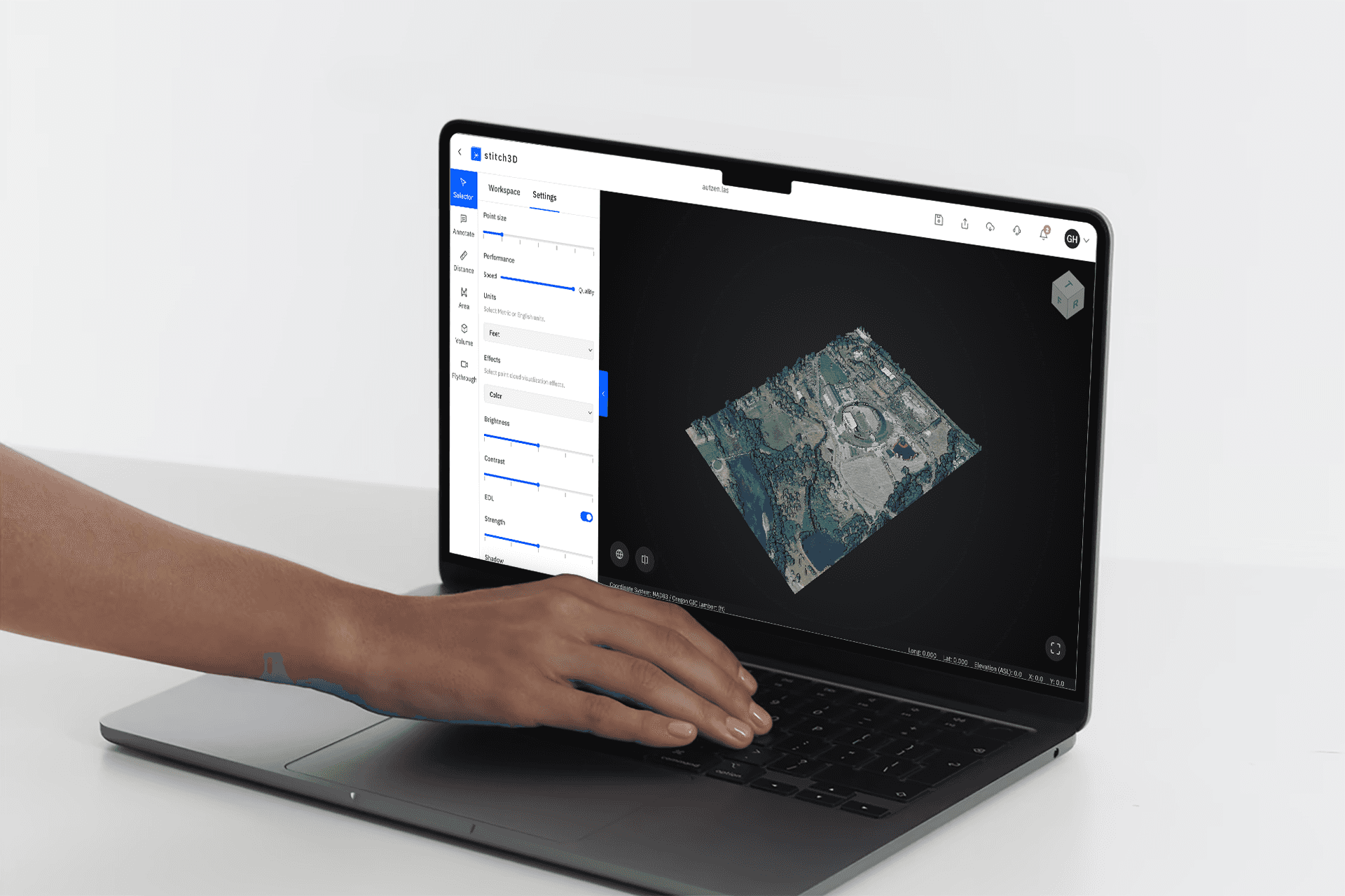
I worked at Stitch3D as a design and engineering intern. I collaborated with both the Web Viewer and Mobile teams to enhance our B2B cloud-based LiDAR 3D mapping solutions.
As the design lead for three revenue-driven features, I was responsible for translating business requirements into intuitive and interactive 3D computing experiences.

Additionally, I contribute to front-end development by translating design components into functional code.
Additionally, I contribute to front-end development by translating design components into functional code.
1 /
Enhanced 3D File Sharing for Business Clients
1 /
Enhanced 3D File Sharing for Business Clients
Our major business clients are seeking advanced 3D file sharing solutions with innovative tools to streamline the process. As the Design Lead, I collaborated closely with engineers to make the data visualization viewer more interactive. I implemented real-time collaboration features that allow users to markup, annotate, and add comments to point clouds alongside up to four other users, enabling a seamless and simultaneous 3D experience.
Our major business clients are seeking advanced 3D file sharing solutions with innovative tools to streamline the process. As the Design Lead, I collaborated closely with engineers to make the data visualization viewer more interactive. I implemented real-time collaboration features that allow users to markup, annotate, and add comments to point clouds alongside up to four other users, enabling a seamless and simultaneous 3D experience.


2 /
Georeferenced Mapping Simplification
2 /
Georeferenced Mapping Simplification
One of my key roles was to translate complex geo and LiDAR functionalities into user-friendly workflows. My primary contribution involved creating tools within the interface that enable users to layer their georeferenced point clouds onto 3D satellite or street base maps, providing full context for their data. This feature is highly beneficial because Stitch3D automatically detects the point cloud's Coordinate Reference System (CRS) projection and aligns user data with precise accuracy. Additionally, I led the expansion of the reprojection design, allowing users to redirect or change their CRS as needed.
One of my key roles was to translate complex geo and LiDAR functionalities into user-friendly workflows. My primary contribution involved creating tools within the interface that enable users to layer their georeferenced point clouds onto 3D satellite or street base maps, providing full context for their data. This feature is highly beneficial because Stitch3D automatically detects the point cloud's Coordinate Reference System (CRS) projection and aligns user data with precise accuracy. Additionally, I led the expansion of the reprojection design, allowing users to redirect or change their CRS as needed.
3 /
Revamped Toolbar and Dashboard for the 3D Viewer
3 /
Revamped Toolbar and Dashboard for the 3D Viewer
I spearheaded the redesign of the toolbar and dashboard for the 3D viewer, enhancing the connections between each category in the panel to deliver valuable analytics, such as stockpile volume. With the improved volume tool, users can perform quick LiDAR scans to accurately forecast material revenue or costs, providing essential insights for decision-making.
I spearheaded the redesign of the toolbar and dashboard for the 3D viewer, enhancing the connections between each category in the panel to deliver valuable analytics, such as stockpile volume. With the improved volume tool, users can perform quick LiDAR scans to accurately forecast material revenue or costs, providing essential insights for decision-making.


